Listening to Aeronautical radio is popular with a lot of short wave listeners, and there is plenty to hear as flights follow the North Atlantic or Pacific oceanic routes. Twice daily, Gander and Shanwick track and direct a barely subsonic herd of aircraft across NAT MNPS airspace. Between California and Hawaii, there is a constant stream of flights crossing each way, calling in position and weather reports to San Francisco.
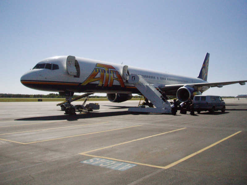
Early in my short wave listening, I discovered the fascinating world of aeronautical monitoring and have been fortunate to be one of the voices. I flew the 757 and 737 for ATA Airlines, and it was a common task to make a crossing. Have a look at some photos and links that describe a pilot's experience flying across the oceans.
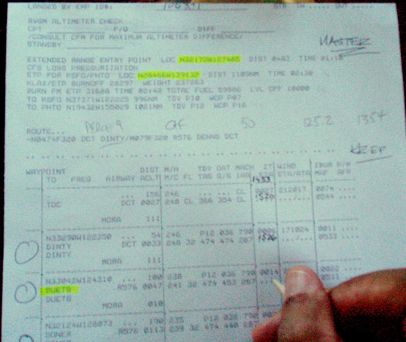
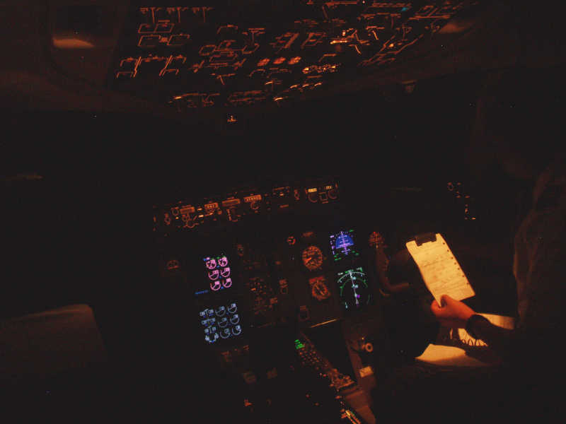
Before departing, we have a lot to do on the flight deck. Normal preflight checks are done, plus plenty of repeat-checking as it relates to the routing, weather, and fuel requirements. At ATA Airlines, 757 and 737 crews used a special Navigation Checklist to cover the additional items required for ETOPS flights. For example, flights across the North Atlantic are given a "track message" specifying the routings prepared by either Gander or Shanwick. One of the pilots will plot those tracks on an oceanic chart, placing symbols to define the route to be flown, its "equal time point," and other information the crew may want to indicate geographically. Another particular ritual conducted at this time is the "route crosscheck." One pilot holds the computerized flight plan, reading the waypoint names, distances, and courses aloud, while the other pilot verifies corresponding data in the flight management computer. It is a deliberate two person job to make sure there are no errors in the route to be flown.
|
ATA Boeing 757-300 |
F/O writing ETAs on flight plan. |
Chart study in dark flight deck. |
After departure, the crew will call the HF radio facility for the first part of the ocean crossing and obtain the current frequencies and check the selective calling equipment. If you hear a carrier wave for a few seconds, followed by someone asking for frequencies and a SELCAL check, that is what is happening. Well before reaching the "coast out" point, the air traffic controllers will have conducted another procedure with the crew: issuing the oceanic clearance. ATC will read the clearance, and the pilot communicating will read it back, plus specify the numeric track message identifier received before departure. The routing, altitude, and Mach numbers are essential parts of the clearance, and both pilots normally write down what they hear from ATC. Note that the Central - East Pacific routes don't use track messages; a simple IFR clearance is sufficient. About 150 to 200 miles beyond the coast, ATC terminates radar service and advises the flight to switch over to HF position reporting. The VHF radios are then set to 121.5 (guard), 123.45 (air to air), and the company ops frequency. Transponder code 2000 is set until re-entering radar controlled airspace. HF #1 is set to the primary frequency in use, and HF #2 is set to "DATA" mode. Then the flight makes plenty of data bursts for the HFDL monitors out there.
Note that there are some operators, with fat budgets, who use satellite communications, or a data-link system called CPDLC, don't have to bother. with HF position reporting on oceanic flights. No fun for them...it reduces the experience of crowded HF frequencies to noiseless VOIP and text-messaging. Aside from communications, the work is similar for anyone doing class II navigation - regular checking of fuel burn, time estimates, upper air conditions, and the quality of on board coffee. There is a whole order and rhythm, as shown by example of the Nav Checklist. Crossing each reporting point, the pilot monitoring will turn up his communication panel's HF audio gain, and call the facility working his geographic area, and make a position report. This will be repeated until the flight is advised to make their next report to ATC on a VHF frequency nearing "coast-in." The crew then sets the next VHF frequency in comm radio #1 and waits. Usually about 200 miles off shore, the ground based ATC signals start breaking squelch. Nearing the coast-in waypoint, with signals strong enough to make contact with ATC, the pilot monitoring will send a position report and receive a squawk code for the radar transponder. Radar tends to not make it as far as VHF signals, so a few minutes will go by before ATC advises "radar contact" and gives the flight a domestic clearance to the destination.
Once, only once, did I receive the mother of all good clearances. It was on the way to Majuro, Marshall Islands. ATC picked up our transponder and cleared us to "cruise flight level three-five-zero and advise on the ground at Majuro...Bye Bye." Talk about a no-hassle arrival! We could descend when ready, fly the approach, and land - only keying the radio to advise starting the descent, and self-announcing near the (uncontrolled - tower closed) airport. In a nutshell, that is how aeronautical radio is used when a jetliner is flown over the oceanic routes.
Iberia 6122 position report.
Airborne HF Aero Radio Equipment
Compared to a typical amateur or SWL station, the aeronautical radio equipment performs to high standards, but does not have much operational flexibility. For example, the oscillators are dead-on accurate and stable, but can only tune in whole 1 kHz steps. There is a tiny RF gain control, but AGC timing is pre-set. There are no filters to notch out carriers or remove the dreaded over-the-horizon radars in use by some countries.
Regarding frequencies, they are selected to provide single-hop propagation between the aircraft and the control center transmitter site. Frequencies are also divided by national registration, in order to reduce congestion. Thus, families A, B, C, etc. Between the west coast of the USA and Hawaii, traffic tends to operate on either 5574 or 8843 kHz, while the North Atlantic region has a plethora of frequencies in use. I suggest referring to a recent aeronautical HF radio frequency list for specific frequencies - and checking the twice daily track message from Gander or Shanwick.
No access to a receiver? You can still listen via receivers streaming audio on the web. There are many listed in this Google search. I heartily suggest a site like Globaltuners or LiveATC.net. Live ATC specializes in worldwide HF and VHF audio streaming, and have a huge variety of sources. Globaltuners has a number of excellent receivers streaming from different geographic locations.
|
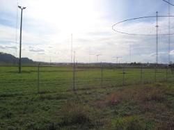
Typical Aero Radio Antenna Farm |
Another Aero Radio Antenna Farm |
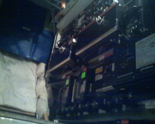
Boeing 757 Electronic Equipment Bay
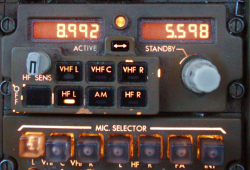
In the center of the above photograph, looking much like all of the other rack-mounted boxes, is the HF transciever - a Rhode and Schwarz XK-516D. The radio is controlled from tuning panels (called RTPs) on the flight deck, and runs about 400W peak power.
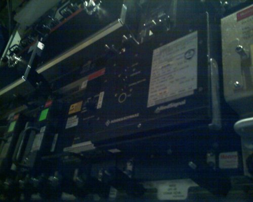
Let's look a bit closer...It is securely mounted in a rack, with a supply of fresh air from the electronic equipment cooling system. The vertical stabilizer leading edge serves as the antenna, and a coupler unit automatically matches the impedance when the transmitter is keyed after changing frequencies.
The XK516D up close.
RTPs aren't glamorous, but they work well!
Most of the equipment is made by Rockwell-Collins or Honeywell- Rhode & Schwartz. Using ATA Airlines as an example, the transceivers were installed as indicated in the following table:
| Aircraft Make / Model | Equipment | Voice | Data | Peak Power |
| Boeing 737-800 | Rohde & Schwartz-Honeywell XK516D | USB/aM | 1.8kbps | 400W |
| Boeing 757-200 | Rohde & Schwartz-Honeywell XK516D Collins HFS-700 |
USB/aM USB/aM |
1.8kbps None |
400W |
| Boeing 757-300 | Rohde & Schwartz-Honeywell XK516D | USB/aM | 1.8kbps | 400W |
| L-1011-3853 | Collins 618T | USB/aM | None | 100W |
| DC-10-30 | Collins 628T | USB/aM | None | 400W |
HFDL On the HF Aero Bands
The first implementations of the Aircraft Communications Addressing and Reporting System (ACARS) saw deployment in the middle 1980s. ACARS greatly shrunk the gap between aircraft, flight crews, maintenance, and dispatch personnel. Instead of relying on phone patches on congested and scratchy voice radio circuits, messaging became something more akin to modern day text messaging. The original messages were limited to departure and arrival times, weather, and limited performance data.
Digital messaging between parties concerned with flight operations have since become more voluminous and sophisticated. Modern aircraft can automatically make routine engine performance observations, check systems status, note the present geographic position and weather, then downlink it all to the operator's maintenance and dispatch facilities. As we have recently seen with the loss of Air France 447, the ACARS / HFDL system dutifully reported a string of malfunctions before going inoperative.
Air traffic control is increasingly a user of data downlinked by aircraft, and not only uses Mode S transponder data, but also position reports and other items essential in the "Future Air Navigation System."
VHF ACARS has a limited range, and is not available over remote areas such as polar regions and over oceans. That is where High Frequency Data Link protocol becomes vital to long range aircraft operators. HFDL is defined in ARINC specification 635-3, and it is operated by ARINC as GLOBALink service through a worldwide network of HF stations. HFDL is actually a blanket term to describe signals of similar format and purpose:
- Transmissions on HF are in USB on a sub carrier of 1440 Hz with a symbol speed of 1800 baud.
- Modulation is 2-PSK, 4-PSK or 8-PSK with effective bit rates of 300, 600, 1200 or 1800 bits/sec.
- Several ground stations provide global network coverage and system status updates.
On board the aircraft, a pilot simply sets one of the HF radios to "DATA" after takeoff, and the HFDL seamlessly integrated into the flight management system.
The ACARS will use HF or VHF depending on what is available. The HF part of the system is usually taken out of "DATA" mode before landing to prevent inadvertent RF exposure to ground personnel, since the system will start to tune around and seek a connection to the network as HF conditions change.
HFDL signals are present whenever the HF bands are open, and are actually more robust than voice transmissions. The author has often gotten solid copy of HFDL transmissions while finding voice from the same geographic area to be a struggle. Even when conditions are marginal, a scan of the current HFDL frequencies will often yield readable data. With a suitable computer controlled radio, the HFDL nets can be followed up and down the spectrum with the diurnal cycle of the ionosphere.
Software for receiving High Frequency Data Links:
The following software may be used for reception of HFDL signals, and depending on the package, may enable automatic tuning of the various frequencies used by the network. One only needs to connect the receiver to the computer soundcard line or microphone input. For the more sophisticated control functions, the proper USB, ethernet, or parallel cables must be used between the computer and radio.
Software which can receive HFDL signals:
- PC-HFDL - Version 2.01 written by Charles Brain G4GUO.
- PC-HFDL - Version 1.01 (free) written by Charles Brain G4GUO.
- HOKA Software
Note: PC-HFDL is by far the most popular decoding software, but the system tables must be updated to reflect the current network configuration. Users are advised to do a Google Search for the latest"pchfdl.dat" and "pchfdl.txt" files. There is plenty of configuration information on the internet for the software. PC-HFDL also works well in virtual machines and in Linux (under WINE). Other software is much less well supported.
Table 34 of the ARINC HFDL System
| Node ID | Xmtr Name | 1 | 2 | 3 | 4 | 5 | 6 | 7 | 8 | 9 | 10 | 11 | 12 | 13 | 14 | 15 | 16 | 17 | 18 | 19 | 20 |
|---|---|---|---|---|---|---|---|---|---|---|---|---|---|---|---|---|---|---|---|---|---|
| 01 | San Francisco CA | 21934 | 17919 | 13276 | 11327 | 10081 | 8927 | 6559 | 5508 | 4672 | 2947 | ||||||||||
| 02 | Molokai, HI | 21937 | 21928 | 17934 | 17919 | 13324 | 13312 | 13276 | 11348 | 11312 | 10081 | 8936 | 8912 | 6565 | 6559 | 5514 | 5463 | 4687 | 3434 | 3019 | 2947 |
| 03 | Reykjavik, ISL | 17985 | 15025 | 11184 | 8977 | 6712 | 5720 | 3900 | 3116 | ||||||||||||
| 04 | Riverhead, NY | 21934 | 21931 | 17952 | 17934 | 17919 | 13276 | 11387 | 11354 | 11315 | 10027 | 8912 | 8885 | 8831 | 6661 | 6652 | 6646 | 5652 | 5523 | 3428 | 3410 |
| 05 | Auckland, NZL | 21949 | 17916 | 13351 | 11327 | 10084 | 8921 | 6535 | 5583 | 3404 | 3016 | ||||||||||
| 06 | Hat Yai, THA | 21949 | 17928 | 13270 | 10066 | 8825 | 6535 | 5655 | 4687 | 3470 | |||||||||||
| 07 | Shannon, IRL | 11384 | 10081 | 8942 | 8843 | 6532 | 5547 | 3455 | 2998 | ||||||||||||
| 08 | Johannesburg, AFS | 21949 | 13321 | 8834 | 4681 | 3016 | |||||||||||||||
| 09 | Barrow, AK | 21937 | 21928 | 17934 | 17919 | 11354 | 10093 | 10027 | 8936 | 8927 | 6646 | 5544 | 5538 | 5529 | 4687 | 4654 | 3497 | 3007 | 2992 | 2944 | |
| 11 | Albrook PAN | 21940 | 17901 | 10063 | 6589 | 5589 | 2902 | ||||||||||||||
| 13 | Santa Cruz, BOL | 21997 | 21988 | 21973 | 21946 | 17916 | 13315 | 11318 | 8957 | 6628 | 4660 | 3467 | 2983 | ||||||||
| 14 | Krasnoyarsk, RUS | 21990 | 17912 | 13321 | 10087 | 8886 | 6596 | 5622 | 4679 | 2905 | 2878 | ||||||||||
| 15 | Al Muharraq, BHR | 21982 | 17967 | 13354 | 11312 | 10075 | 8885 | 5544 | 2986 | ||||||||||||
| 16 | Agana, GUM | 17919 | 13312 | 11306 | 11288 | 8927 | 6652 | 5451 | |||||||||||||
| 17 | Telde, Gran Canaria, CNR | 21955 | 17928 | 13303 | 11348 | 8948 | 6529 | 5589 | 2905 |
For the most up-to-date support, see the Yahoo! HFDL Forum.
As this is being written, the author is in Asia, using a Web controlled software defined radio located in the Netherlands to monitor North Atlantic HFDL traffic in the 10 MHz aero band. The digital audio is being piped directly to PC-HFDL, and the data is squeaky clean. That is mighty slick listening!
© 2005 - 2025 AB9IL.net, All Rights Reserved.
Written and curated by Philip Collier / AB9IL.
About Philip Collier / AB9IL, Commentaries and Op-Eds, Contact, Privacy Policy and Affiliate Disclosure, XML Sitemap.
This website is reader-supported. As an Amazon affiliate, I earn from qualifying purchases.
